|
 News News
Subscribe to Our Newsletter
Sign up for Email Updates
CGF In the News
Press Inquiries
Past Articles
Calendar
Learn about the Update process for the Mid-Coast
LCP in our Fall 2003 newsletter article.
Get involved in the update process!
Read the Mid-Coast LCP online
.
|
|
|
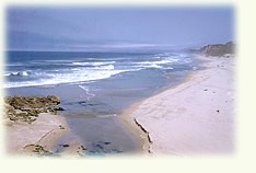
The Coastal Act gets local
A Local Coastal Program Primer
by Lennie Roberts

 Back in 1972, efforts to
protect coastal resources got a huge jump-start with the passage of Back in 1972, efforts to
protect coastal resources got a huge jump-start with the passage of
Proposition 20
. Four years later, the Legislature passed the California Coastal Act, which required each city and county in the state that has land within the Coastal Zone to prepare a Local Coastal Program (LCP) that outlines how the 1976 California Coastal Act
will be implemented on a local level. The Coastal Zone is a boundary of variable width, bounded by a line three miles out at sea to an inland boundary that varies from a few blocks (in more
urban areas) to approximately five miles inland in less-developed settings, such as in San Mateo County.Document establishes priorities for land use
Over the last 30 years, Local Coastal Programs statewide have
become critical documents governing land use in the Coastal Zone. Each LCP is made of two parts: the Local Coastal Plan Policies and accompanying tables and maps, and the more detailed Implementing Ordinances.
The Coastal Act and the LCP establish priorities for land uses in the Coastal Zone, giving coastal resources and sensitive habitats highest priority for protection, enhancement and restoration. Protection of
agricultural land and coastal-dependent industrial
uses are second priority, followed by public recreation, visitor-serving uses and public access. New private residential, general industrial and general commercial development have the
lowest priority under the Coastal Act. Drawing the rural / urban boundary
Locally, LCP policies direct new residential, commercial and industrial development to the urban areas of the coastside
(Montara, Moss Beach, El Granada, Princeton and Miramar) that are subdivided and already served by utilities, and to two Rural Service Centers (Pescadero and San Gregorio), designated to
provide commercial facilities in support of agriculture and recreation and to meet local housing needs. All of these lands are marked by a permanent Urban/Rural boundary.
Outside of this boundary fall the coastside's Rural Areas, which are designated as Agriculture, General Open Space, Timber Preserve or Public Recreation. In these areas, land use must be
consistent with maintaining open space and agriculture; the density of residential, commercial and industrial development is regulated through the use of density credits, which are determined for each
parcel by a matrix of characteristics including soil type, landslide susceptibility and slopes. An LCP is a many-faceted thing
In addition to defining appropriate uses for urban and rural areas,
the Coastal Act and the LCP also require that, where development is proposed, the applicant must demonstrate that there will be no significant impact on coastal resources, including
wetlands, streams and riparian corridors, marine habitats, sand dunes, sea cliffs and habitat of rare and endangered species.  The LCP works to protects scenic and visual qualities of the Coast by requiring new non-agricultural development to be located in a manner that is least
visible from State and County Scenic Roads and best preserves the visual and open space qualities of the parcel overall. The LCP works to protects scenic and visual qualities of the Coast by requiring new non-agricultural development to be located in a manner that is least
visible from State and County Scenic Roads and best preserves the visual and open space qualities of the parcel overall.
The many facets of the Local Coastal Program also include other
land use planning policies, among them affordable and farm labor housing, hazards, energy, aquaculture, access to the shoreline, recreational facilities, commercial fishing and recreational boating.
Sanctioned by the people of California to protect our coastal resources, our Local Coastal Program is one of the best instruments we have to govern land use. As resources dwindle
while populations increase, these policies can help guide us to make wise decisions to provide for the future livability and sustainability of our communities and the Coastal Zone. Read our Fall 2003 newsletter article about the LCP update process.
For information about how to participate in the update process for the Mid-Coast LCP, visit our action alert
.Copies of the LCP are available for purchase in the County Planning Division on the second floor of the County Government Center Building, 455 County Center, Redwood City, 94063
Published October 2003 in Green Footnotes
Page last updated November 13, 2003 . |
|